Photos | Navigating the City
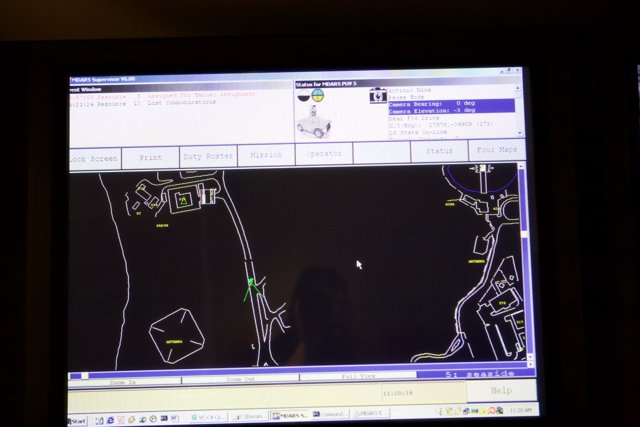
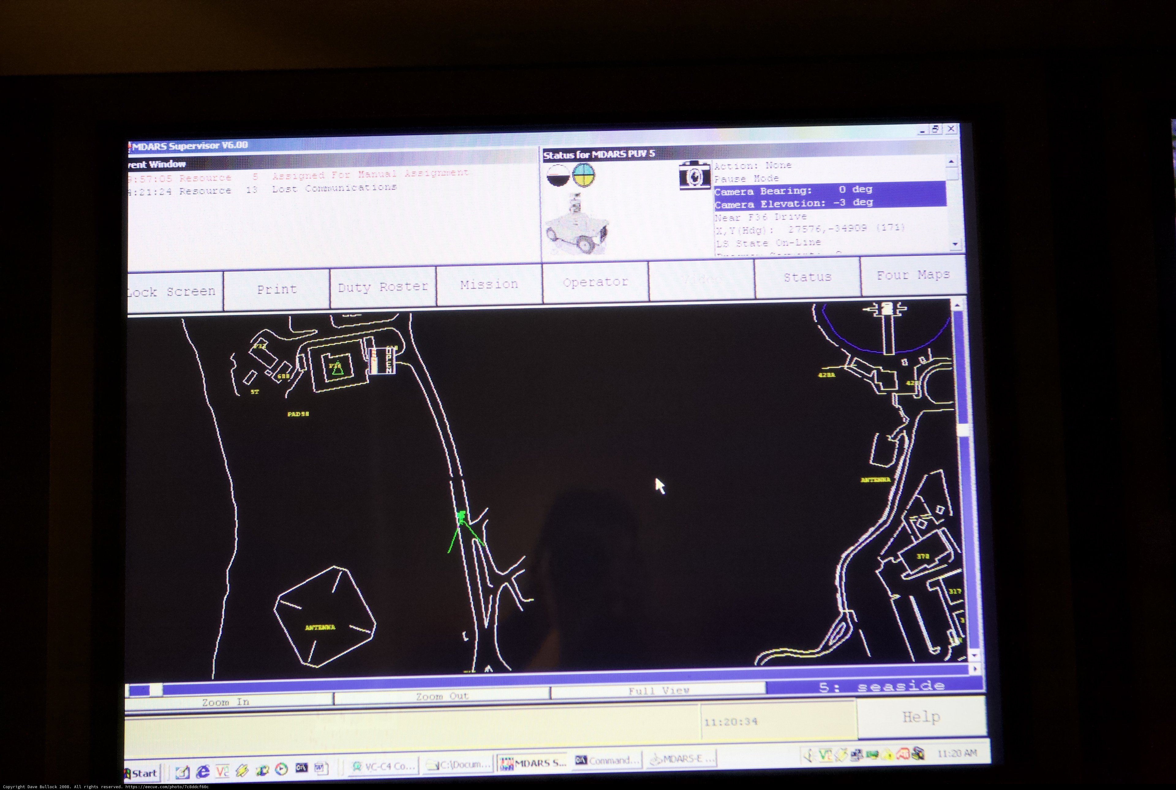
This computer screen shows a detailed map of the city, complete with GPS coordinates for accurate navigation.
BLIP-2 Description:
a computer screen showing a map of a cityChronologically Adjacent
Note: You can also navigate with your arrow keys or swiping.
Metadata
Capture date:
Original Dimensions:
4368w x 2912h - (download 4k)
Usage
Dominant Color:
deg supervisor status ca resource window roster blackboard plot operator transportation lost help lock bearing co plan document zoom duty hardware camera chart four nane mission gps diagram pun electronics car vehicle screen spawar monitor rent maps ve communications bstart tv pause mdars 多 mode print computer smdars vc
Detected Text
iso
1600
metering mode
5
aperture
f/2.8
focal length
50mm
shutter speed
1/160s
camera make
Canon
camera model
lens model
date
2008-01-22T11:08:03-08:00
tzoffset
-28800
tzname
America/Los_Angeles
overall
(19.18%)
curation
(25.00%)
highlight visibility
(1.99%)
behavioral
(10.13%)
failure
(-0.85%)
harmonious color
(-1.95%)
immersiveness
(0.27%)
interaction
(1.00%)
interesting subject
(-73.97%)
intrusive object presence
(-7.81%)
lively color
(-16.76%)
low light
(34.94%)
noise
(-7.62%)
pleasant camera tilt
(-9.46%)
pleasant composition
(-32.01%)
pleasant lighting
(-48.85%)
pleasant pattern
(1.29%)
pleasant perspective
(10.00%)
pleasant post processing
(2.28%)
pleasant reflection
(-0.95%)
pleasant symmetry
(1.46%)
sharply focused subject
(0.95%)
tastefully blurred
(-4.74%)
well chosen subject
(5.09%)
well framed subject
(20.74%)
well timed shot
(0.80%)
all
(-4.51%)
* WARNING: The title and caption of this image were generated by an AI LLM (gpt-3.5-turbo-0301
from
OpenAI)
based on a
BLIP-2 image-to-text labeling, tags,
location,
people
and album metadata from the image and are
potentially inaccurate, often hilariously so. If you'd like me to adjust anything,
just reach out.